
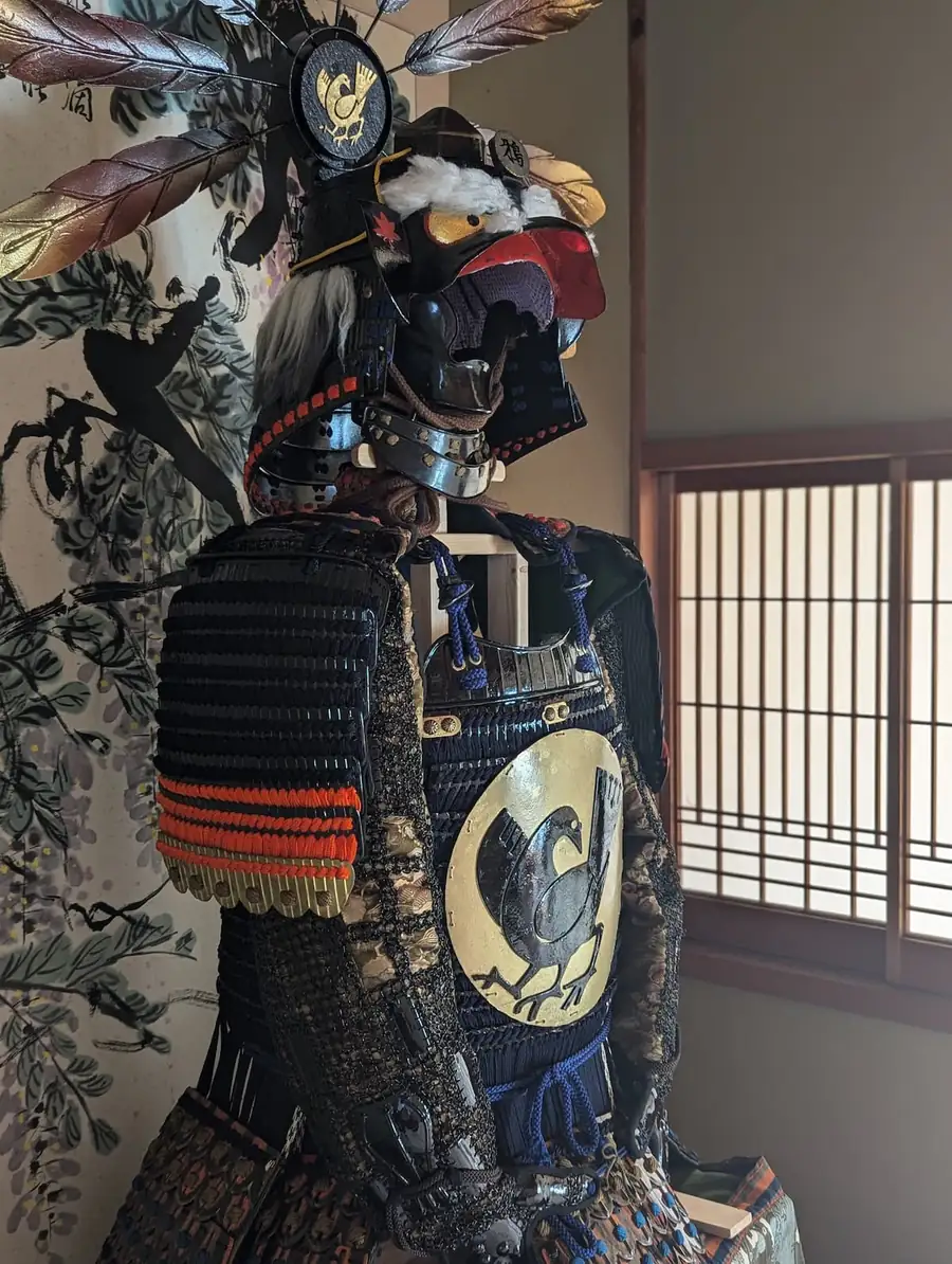
Crow tengu armor
A suit of armor shaped like the karasu-tengu, the crow-like spirit of Japanese folklore, made with uchidashi — the traditional technique of hammering metal plates into shape. Even the eyebrows were set by hand, one by one.
The story of this place
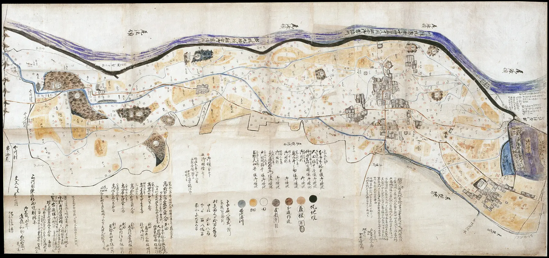
The main house, more than 100 years old, belongs to the Kondo family, who served as headman (shoya) of Nishizakai Village in the Edo period. Your hosts are their descendants.
Check dates on AirbnbRight between Tokyo and Kyoto/Osaka, Aichi gave Japan the three great unifiers of the samurai age — Oda Nobunaga, Toyotomi Hideyoshi and Tokugawa Ieyasu. Today it is the heart of Japanese manufacturing and the home of Toyota. Nagoya Castle, Ghibli Park and centuries-old pottery towns are all within a drive.
A castle town once ruled by the Mizuno clan, the family of Tokugawa Ieyasu's mother, Lady Odai. Today global auto-parts makers such as DENSO, Toyota Industries and AISIN have their headquarters here — and wild irises, the city flower, still bloom in a pond protected as a National Natural Monument.
On Kariya's northern edge, among the rice fields, lies a small place called Hanaike — "flower pond." Our name comes from it. Here, one family has lived and kept its home since the Edo period.
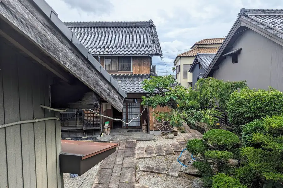
About 50 years ago, an old map was found in the main house: the Map of Nishizakai Village, Hekikai District, Mikawa Province, drawn in 1862 at the very end of the Edo period. Its maker was Kondō Wasuke, the village headman at the time — an ancestor of your hosts. The original is now kept at the Kariya City Museum of History.
Why a secret? The map showed things meant only for the villagers, such as the location of hidden rice fields. A note attached to it is said to have warned: "Do not show this to the domain officials."
Look closely and you'll see tiny stamps on the fields. Red circles mark land of the Mizuno family of the Numazu Domain; gray squares mark land of the Katō family, direct retainers of the shogun. Under this system, called aikyū, even neighboring paddies paid their taxes to different lords — a mosaic of rules that the headman had to keep track of.
 123456
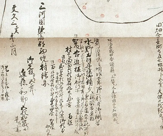
Bottom left: the title, "Map of Nishizakai Village," and the date, 1862. Nearby, an inscription reads "Kept by the family of Kondō Wasuke, handed down from our ancestors." Proof that this map has stayed with the Kondo family for generations.
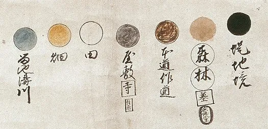
Drainage streams, upland fields, rice paddies, houses and temples, roads and woods are each painted in their own color. Yellow is fields, white is rice paddies, gray is houses — most of Nishizakai was farmland.
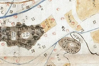
Look closely at the tiny stamps on the fields. Red circles mark land belonging to the Mizuno family of the Numazu Domain; gray squares mark land of the Katō family, direct retainers of the shogun. Even neighboring paddies paid their taxes to different lords.
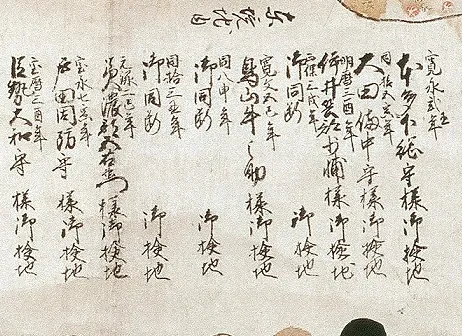
Starting with Honda Shimōsa-no-kami in 1625, the map lists the official land surveys carried out over the years. Every time the rulers changed, the land of Nishizakai Village was measured again.
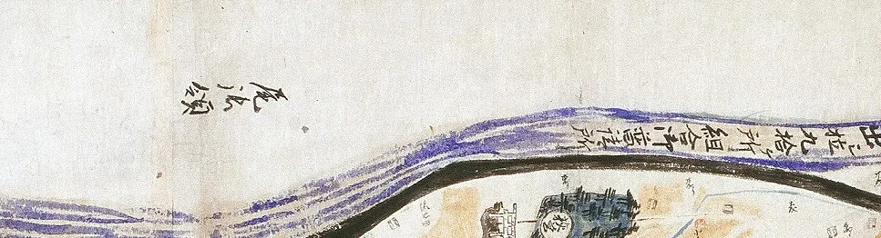
The blue band at the top is the Sakai River ("border river"); beyond it is written "Owari territory." It marked the border between Mikawa and Owari provinces. The land on its left (Mikawa) bank was called Sakai Village, and its western part was named Nishizakai, "West Sakai." Sand built up in the riverbed until it ran higher than the land around it, and Nishizakai Village often suffered floods.
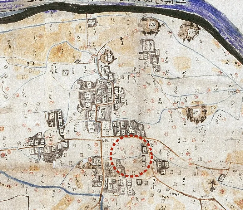
Just south of the center, where the houses cluster (today's Hongō). Comparing the old map with today's, Hanaike Retreat would be somewhere around here (our best estimate).
Perhaps, as Wasuke drew this map, he imagined people far in the future looking at it. More than 160 years later, you are staying in his descendants' home.
A suit of armor shaped like the karasu-tengu, the crow-like spirit of Japanese folklore, made with uchidashi — the traditional technique of hammering metal plates into shape. Even the eyebrows were set by hand, one by one.
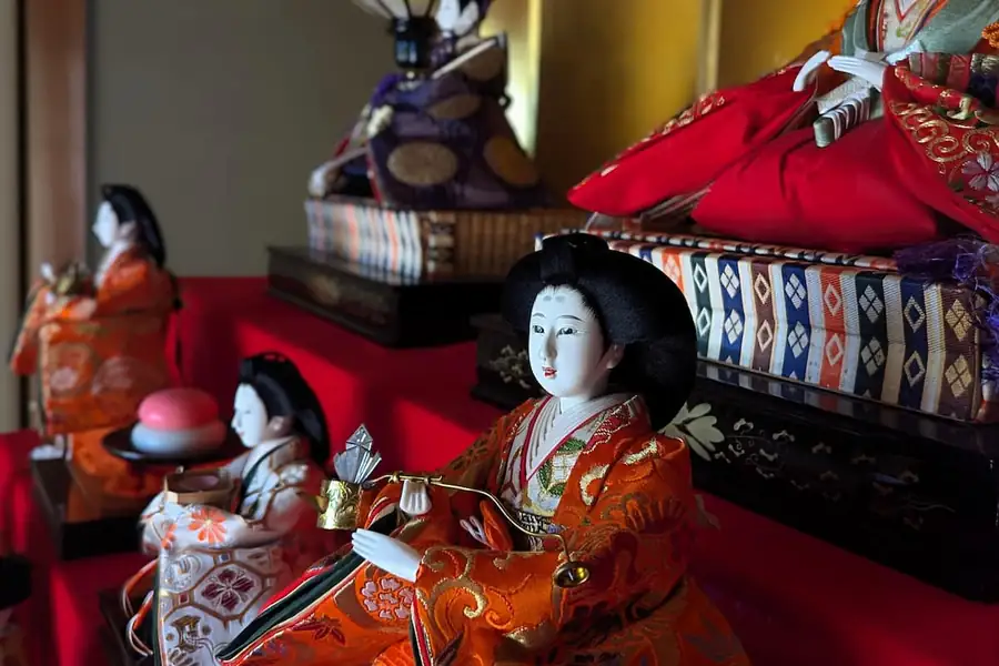
Tiered dolls of the imperial court, displayed each year around March 3, the Girls' Festival, to wish girls health and happiness. The hosts can show you theirs on a tour of the main house.
When the hosts are home, they can show you both during a short tour of the main house.
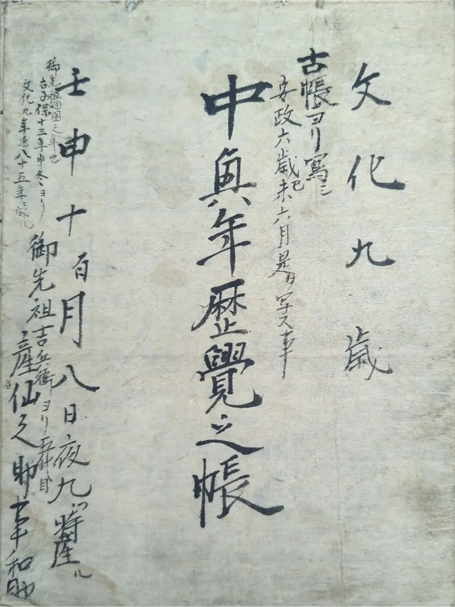
Kondō Wasuke also kept a notebook of events in the village and its neighbors. Fireworks appear in it again and again: at the 1869 festival of Akiba-san, the god who protects against fire, at a nearby temple; in a request to use tezutsu hanabi, the handheld bamboo fireworks of this region; and in a sad record of an accident at a neighboring village's festival.
Staying in summer? The Kariya Wansaka Festival fireworks (usually in August) carry on that tradition.
Source: Kariya City Museum of History.
The Nishizakai on the old map is still small enough to explore on foot. A loop of about 2 km (40 minutes) takes in old Zen temples, Sakai Shrine — said to be the home of the Sakai clan, top retainers of the Tokugawa shoguns — and the Sakai River embankment, once the border between the provinces of Mikawa and Owari. We share the route map after you book.
See prices and open dates for your group on Airbnb. Up to 5 guests, 2 free parking spaces.
Check dates on AirbnbBooking, payment and support are handled by Airbnb.